















 Cloud Login
// fleet data
AutoPi Mini
Verify supported EV/OBD vehicles and parameters for standard fleet data.
Explore MiniAutoPi Geofencing lets you model depots, jobsites, customer locations, and corridors as precise polygon or radius zones on a live map. Vehicles stream GPS position and status into AutoPi Cloud, where entry, exit, and dwell events are computed in real time from the underlying telemetry. Zones can be attached to specific vehicles, asset groups, or tenants, so the same geography can serve different operational purposes across your fleet.
The platform calculates distance in zone, time in zone, and route deviation metrics from raw tracks, turning GPS samples into structured events you can query and report on. Use these outputs to enforce operating areas, protect high-value assets, and distinguish planned movement from exceptions. Geofence logic can drive alerts, workflows, or even immobilization rules when combined with other AutoPi features such as keyless access and maintenance alerts.
All zone events are stored with vehicle ID, zone ID, timestamp, and position, and can be exposed via REST, MQTT, or webhooks to your existing systems. This enables accurate billing based on time-on-site, SLA reporting for arrival and departure times, and analytics on utilization per customer or location. Multi-tenant isolation and configurable retention policies keep large, mixed fleets manageable without losing detail where it matters.
Contact Us
In AutoPi, geofences are not just drawings on a map. Zones are first-class objects with real-time entry/exit events, dwell analytics, and alert rules that connect directly to your operational workflows. Combine them with GPS, keyless access, and maintenance data to enforce operating areas, reduce misuse, and coordinate mixed fleets across sites and regions.

Configure per-zone rules for entry, exit, and dwell violations. Events can trigger alerts, webhooks, or downstream automation so deviations are detected early and handled consistently across shifts, sites, and tenants.
Define polygons or radius-based zones directly on the map and link them to vehicles, drivers, or asset groups. AutoPi continuously evaluates GPS data and emits entry, exit, and dwell events with timestamps and identifiers. Whether you manage a single truck or a distributed machine fleet, you get a precise, queryable history of where each unit has been and for how long.
Use geofence events as triggers for operational logic: notify a loading dock on arrival, start or stop job timers, raise exceptions on early departures, or create tasks for field technicians. Events can flow into Alerts & Notifications, webhooks, or external systems so your routing, dispatch, and billing processes react automatically to what happens in the field.
Model different zone types such as depots, customer sites, restricted areas, or country borders and apply distinct rules to each. Assign zones per tenant, vehicle group, or individual asset, and combine them with keyless access and immobilization policies. The result is a ruleset that matches how your operation actually works, not a one-size-fits-all template.

Correlate GPS traces with zone entry/exit events to understand where each unit operates, how long it dwells, and when it deviates from planned routes.

Create polygon or radius zones, tag them by type, and attach policies and alerts that match your real operational constraints.

Drive alerts, workflows, and integrations directly from zone events without manual checks or spreadsheets.

Capture zone-based activity for each vehicle to support billing, payroll, compliance, and utilization analysis.
Geofencing in AutoPi links map zones with GNSS telemetry, event rules, and reporting. Compute zone entry, exit, and dwell, enforce policies at the edge or in the cloud, and expose location-based metrics for safety, utilisation, and customer commitments.
Configure alerts on zone entry, exit, or dwell time and route them to operators or external systems. Use them to detect unauthorized movements, missed or late arrivals, excessive dwell at specific locations, or assets leaving restricted areas. Alerts are handled by the AutoPi Alerts & Notifications engine and can be forwarded via email, webhooks, or integrations into incident and ticketing tools.
High-resolution GNSS combined with geofences moves beyond simple “dot on a map” views. AutoPi records latitude/longitude, current zone, and dwell intervals. This enables automated route compliance checks, turnaround time calculations, and precise proof-of-service for contracts and SLAs, all derived from the same event stream.
Combine zone events with fuel and engine signals to localise where consumption is wasted: long idle periods at specific depots, repeated detours outside planned corridors, or inefficient routing between hubs. Use this dataset to refine routes, reduce deadhead mileage, and keep vehicles operating within the most efficient patterns for your network.


Geofence analytics provide a structured view of how assets move between locations over time. Aggregate zone visits, dwell distributions, and activity per vehicle, route, or customer and feed this into planning and fleet management processes. This supports maintenance scheduling, verification of service levels, and allocation of capacity to the sites that actually generate demand.
Bind driver-behaviour metrics to specific zones such as depots, school areas, or customer sites. Use zone-aware speed, harsh events, and idle statistics to enforce local policies, reduce risk in sensitive areas, and document adherence to site-specific safety requirements.
Quantify how long vehicles, trailers, or machines spend parked versus in productive zones. Geofencing highlights underutilised assets and supports decisions on redeployment, right-sizing, or additional investment. Combined with maintenance and cost data, it helps ensure that high-value equipment is used where it yields the most operational value.
// your proof of concept
Let's find the right hardware for your vehicles, validate the data you need and plan the integration together.
// fleet data
Verify supported EV/OBD vehicles and parameters for standard fleet data.
Explore Mini// vehicle-bus logging
Evaluate J1939, CAN FD and vehicle-bus data logging.
Explore CAN-FD Pro// custom edge software
Develop Docker workloads and custom edge software.
Explore TMU CM4Confirm vehicle power, connectors, adapters and any required external sensors. An accessible connector does not guarantee that every requested signal is available.
Compare device capabilities// project scope
// from testing to rollout
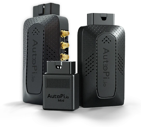
We'll help you choose devices to purchase for representative vehicles, then work with you to extract the data you need, including reverse engineering where needed. Together, we'll agree the scope and acceptance criteria, validate the captured signals and integration, then decide on rollout.
Discuss your PoCGet in touch with us - we're ready to answer any and all questions.